Shelter

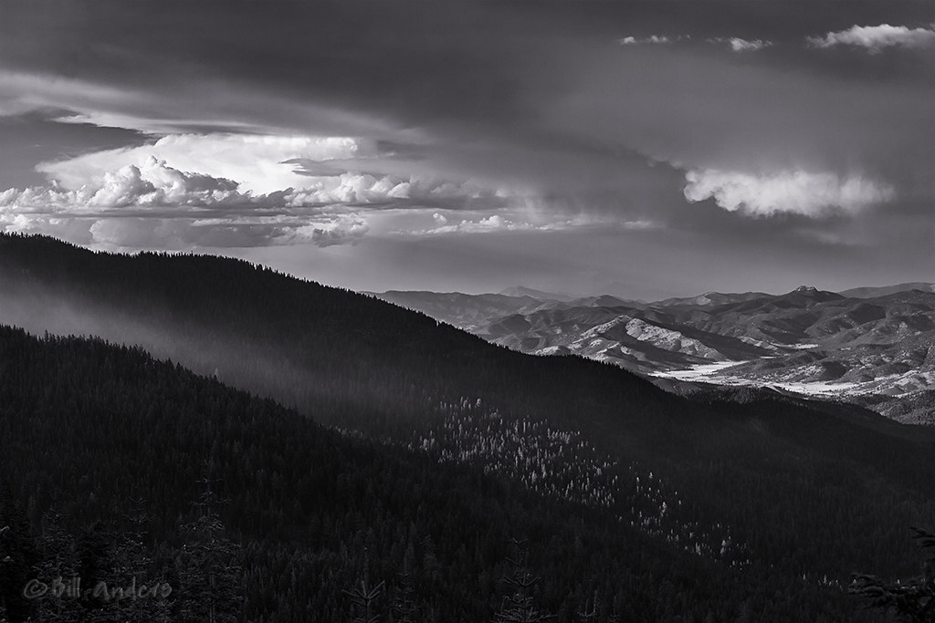
Another TBT to last July in the Sisters Wilderness of Central Oregon.

My fantastic shelter, a Yama Mountain Gear Swiftline. This was the only shelter for Goddess and I during our 2015 PCT thru-hike. In 2017 it was my shelter during three weeks of trail maintenance on the PCT.*

For those of you who have kept track, it has been used and abused for well over 200 nights, packed for close to 3,000 miles.

One of these days, we’ll be sad to see it go. But it will be replaced with another of Gen Shimizu’s hand-crafted ultralight tents.

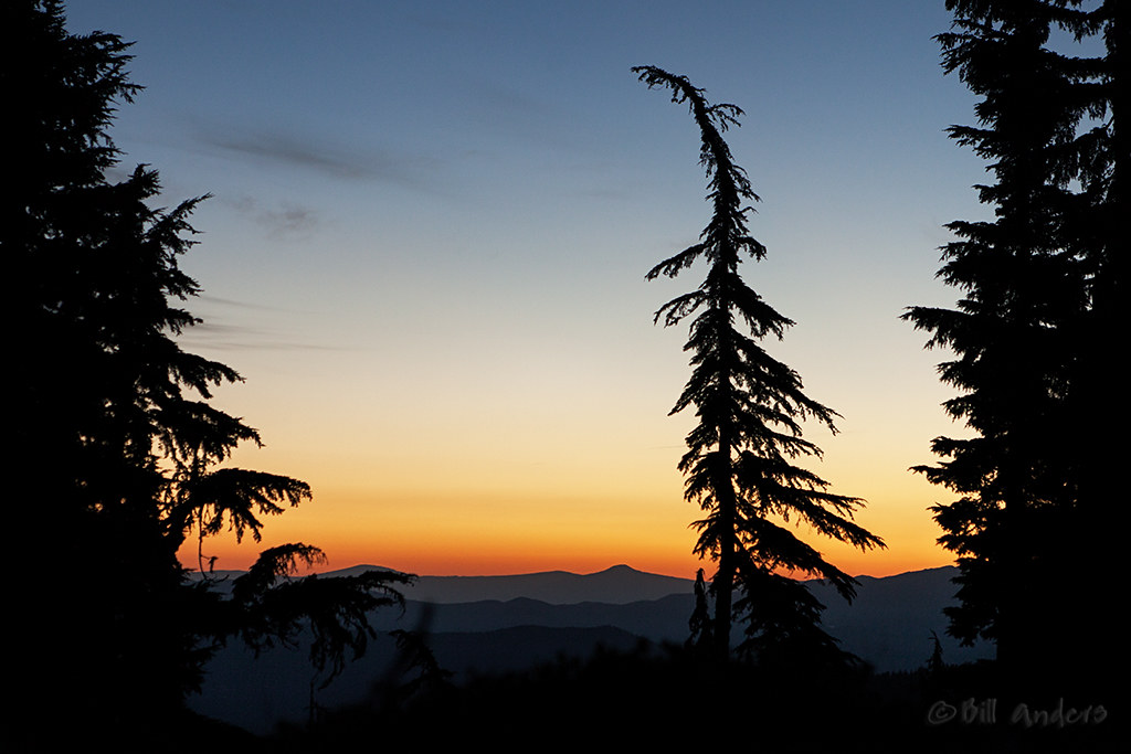
I was glad to capture the sun setting behind the tent this particular evening. A few days later, I would be diving into it quickly after dinner, glad for the protection from Oregon’s Air Force, the gazillion mosquitoes that would be plastered against the screen, hoping for a meal.

And while we are enjoying everything that this winter has to offer, looking at these pics has me looking forward to summer. But just a little bit. There’s still plenty of winter to enjoy.

———

* full disclosure for those relatively new here – Yama Mountain Gear sponsored us during our PCT thru-hike, providing not only the tent pictured, but arranging for other gear and mentoring to help us succeed. We did. We have been under no obligation to continue discussing the products after 2015, but continue to do so because we truly believe that Gen crafts truly great lightweight and ultralight tents, as well as other gear..

Middle Sunset

A TBT to last July, when I hiked back into the Sisters Wilderness of Central Oregon, relaxed by myself for night, then hiked back out to meet a trail crew, just to return to the same spot for a week.

This was the view from my tent site. Really not a bad way to spend summer evenings.

Cascade Sunset

TBT*, something I typically don’t do, but I have a lot of catching up to do with pics that haven’t been posted here.

One of my favorite sunsets from last summer, sitting with Goddess on a big pile of lava, looking north towards Mount Jefferson just a few days before the big fire that roared through its wilderness area.

*TBT=throwback Thursday, for those of you not hep to the lingo.

Back to Basics

After the last post, featuring a picture that had more post-processing than I normally get involved in, it’s time to get back to basics.

Lines.  Shapes.  Shades.

Back to Basics

Whitebark Pine clinging to the ridge of the northwest rim above Crater Lake, Oregon.

The blue background is the lake, some 1,200′ below this tree.

Thielsen Stars

About an hour and 15 minutes prior to the image that I posted last, the hints of dawn were already visible.

After an hour of trying to get star images through the moving clouds, the first hints of light started at astronomical twilight.  This image unfolded half an hour later, just a few minutes before nautical twilight, as the sky really started to brighten directly behind Mount Thielsen.

The rapidly changing light was quite a treat, but nowhere near the treat as watching Jupiter (just left of frame center) rise in the eastern sky, visible well after sunrise.

Thielsen Stars

The surprise in this image was the airplane directly over the peak.  I don’t recall seeing it when I took the picture, but there were quite a few out that morning.  Their low rumble was the only man-made sound I heard for a few hours.

That alone made getting up to watch this worthwhile.

Wildhorse Lake

We were disappointed in the lack of clarity in the sky, as there are several wildfires in the region.  Luckily we got there when we did, as a thunderstorm rolled through two days later and started a wildfire on the slopes.

Wildhorse Lake

Steens Mountain, Oregon.

Unfortunately, we didn’t make the hike down to the lake.  You can see the trail extending down from the lower left, using switchbacks to drop down the steep slopes toward the lake.  It’s only about two miles round trip, but in our haste to pack the car and drive out to southeast Oregon, we left all of our water carrying bottles and bladders at the house and the water filter was back at the camp.  So at the elevation (~9,000′) on a hot day, we wisely decided to not make the jaunt.  Oh well, a good excuse to return to the lake.

Perhaps even camp.

Vanishing Point

Long time followers know I love lines. They are usually man-made, but it’s nice to see good ol’ Mother Nature provide some once in a while.

Although these aren’t perfectly straight, they all lead to that vanishing point.

Hidden Lake Trail, Trinity Alps Wilderness Area, Klamath National Forest, California

Luckily I got this view the day before the fires started.  Otherwise the sky wouldn’t have had the clarity that it did.

The Start

Entering frame left is smoke from the Leef Fire, started by lightning from the storms that moved north and are visible in the distance.

We were much too close to the lightning strike that started that fire.

But once we got back to camp, we had a front row view of the attack, with ground crews moving in, smoke jumpers dropping in, and myriad aircraft monitoring and dropping water and retardant.

It was a bit fun.

The Start

In the following days, thousands of acres of forest would go up in flames as thunderstorms continued.  Almost two weeks later, many of those fires are still burning.

And for those that know the area, if you look real close at the horizon just right of frame center, you’ll see the faint outline of Mount McLoughlin.  Before the rain and smoke, Pilot Rock was also visible.  So I’d joke that I could see home from where we were working.

Lunchtime and Fires

A couple of snaps from a long day working on and hiking trail.  Longer than anyone expected, as the 7.5′ maps didn’t show quite a bit of trail detail (e.g., switchbacks) that we needed to know.

Once the fires started, the trail we were sent to work on, the Pacific Crest Trail (PCT), was closed to the public so that firefighters could move freely on it.  Not to mention, parts of the trail passed close to the rapidly growing fires.  Since that trail was closed, we shifted gears and tackled a few local trails that had been sorely neglected for quite a few years.

The first was the Long Gulch Trail.  Quite a bit of clearing brush and rebuilding trail that morning, but we were lucky enough to make it to Long Gulch Lake for lunch.  A few folks jumped into the water while most of us just enjoyed the scenery.  Those that swam regretted it later as the chafing set in on a long loop hike back to camp.

Long Gulch Lake

This is the view of the lake a couple of hours later as we worked the trail up to the ridge line.

Here is a map that some folks built of their three day hike of the same loop that we worked and covered in 10 hours.  But to be fair, we only worked the uphill portion of the Long Gulch Trail, then moved quickly through the rest of the loop to get back down into the valley.

Long Gulch Lakes Loop

We moved quickly through the hike portion once we reached the top of the Long Gulch Trail.  We received word from the Forest Service that we were not to dilly dally, as the Coffee Fire was just a few miles away and blowing up in the dry, hot, windy afternoon conditions.  We could see a bit of the smoke plume from the top of the summit, but had a chance to really get a look at it less than 1/2 mile later as we hiked under the south side of the ridge line.

Coffee Fire

The picture makes it look quite a bit further than it really was.

As we dropped down the switchbacks towards Trail Gulch Lake, we had a front row view of the helicopters dropping down over the lake and scooping up water to drop on the surrounding fires.  That made for a complete experience.

Over a week later, the Coffee Fire is still going, having burnt over 6,000 acres, but is 60% contained this morning.  However, our entire area is in a Red Flag Warning for the next 48 hours as another round of thunderstorms, with little rain, spread over the forests.

It’s just that time of year out west.

PCT Sunrise

A perfect response to my last post, Magenta Sunset.

PCT Sunrise

This sunrise was nine days later and about sixty miles as the crow flies, although driving time is a few hours.

This was the view from my tent.  I didn’t even need to lift my head to see it, instead I would roll on my side and unzip the screening for a clear view.  It was a view that I could quickly get used to.

Too bad I didn’t have the chance.

I spent nine days with a work crew on the Pacific Crest Trail (PCT).  The crew consisted of volunteers with the PCTA, as well as young AmeriCorps volunteers working through the American Conservation Experience (ACE).  We were responsible with rehabilitating a stretch of the PCT north of Carter Meadows Summit, which sits on the boundary between the Klamath National Forest to the north and the Trinity Alps Wilderness to the south.  That was the plan.

But plans change.

On the afternoon of our first day of work, thunderstorms popped up.  Quickly we got wet, but then the hail started and a very close lightning strike (within 1/4 mile)  really got the crew on edge.  But not as much as the smell of smoke just a few minutes later.  Within 30 minutes we were hiking off the trail, stepping aside to let the first ground firefighting crew get by.  We spent the rest of the afternoon back at camp watching the activity as smoke jumpers dropped into the very steep terrain, then watched water drops continue until dark.

Little did we know at the time, but we were at the epicenter of the beginning of the 2014 northern California fire season.  Within days, over 20,000 acres in the surrounding forests were on fire.

This view was the next morning, as the fire smoldered to our northwest.  The little bit of smoke in the air really enhanced the dawn.

I was lucky enough to get one more morning of this view at dawn, but then we were asked to vacate our camp to make room for a forward firefighting camp.  After that we were safely down in the valley, but missing the sunrises and sunsets.  And instead of working on the PCT, we spent the rest of our time working on local trails heading up into the Trinity Alps Wilderness.  That turned out to be a good thing, as those trails were very neglected and sorely needed the attention.